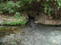
Comal Springs is the largest spring in Texas, and the southwest.
From I-35 in central New Braunfels take the Seguin
Avenue exit and head west. Turn right onto Landa Park Drive and look for the trailhead sign
on the left side of the road.
The Hike: The Panther Canyon Nature Trail is a relatively new trail
that begins in New Braunfels' main park in the center of town, Landa Park. The hike
begins at the waypoint marked "Trailhead". Already, the hiker is provided with a sight
to behold. Just to the south of the trailhead lies Comal Springs, the largest in Texas
and the southwestern United States. The highest recorded discharge from the springs was
over 350,000,000 gallons in a single day in 1977. The water gushing from the springs
twists a few times in Landa Park before joining the Comal River.
-small.jpg)
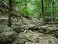
Although the walls of the canyon are steep, the trail itself follows the gentler creek bed.
The trail heads towards the northwest from the trailhead. In general the trail is well
maintained with occasionally rocky surfaces, though packed dirt is more common. Most of
the rocky portions occur at the trail's many creek crossings. In this short hike you'll
cross the creek at least 10 times. Thankfully, the stream is usually dry, as it was on the day of my visit, and so provided no impediments.
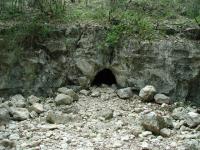
About a tenth of a mile from the trailhead a small cave opening can be seen on the right.
A quick peek into the opening showed an ascending slope covered in rocky debris, leading to pitch darkness. The cave could serve as a discharge point during wetter periods, but
could also serve as the home for some wildlife. Alas, I could see no sign that would tell
whether either of these were true.

This cave lies near the trail, on the opposite side of the creek bed.
It's not that Panther Canyon is not an interpretive trail. I discovered more than 40
numbered stations throughout its length. Although some were destroyed by vandals, the
majority appeared to be in their proper location. I had no prior knowledge of the interpretive
markers and saw nothing at the trailhead which would help me learn more about the cave, or
any of the other features that the markers highlighted.
-small.jpg)
A few segments of the trail are somewhat narrow, but none of it is overgrown.
Panther Canyon plays host to a dule of doves. White-winged doves seem to find the dense
tree cover ideal for their purposes. A dule is a collection of doves, but strangely they
can also be referred to as an arc, a cote, a cove, a dole, an exaltation, a flight,
a flock, a funeral, a true love, a piteousness, a pitying, or a prettying of doves. Feel
free to choose your favorite collective noun from the list. But the doves were not the only
notable bird to be found. At one point I encountered a large Turkey Vulture hopping
and darting, in a somewhat ungainly manner, amongst the branches near a creek crossing.
Considering the bird's awkwardness I could see why I have seldomly seen them in such
heavy cover.

The trail crosses the creek that cuts the valley a number of times.
At the waypoint marked "Forked?" I took a wrong turn, unknowingly. I saw a trail lead
off to the right, but thought the trail ahead was at least as well traveled, if not more so.
Wanting to hike the trail proper and not any maverick trails, I proceeded to the left.
By taking the proper right turn here the hike distance is probably equivalent, but the
trail stops at New Braunfels High School. The fork to the left continues until it runs
into Kentucky Street at the waypoint Turnaround, just a block or two from the school.
I encountered several people on the trail, but no crowds. This was somewhat surprising,
particularly given that upon finishing the hike, back in Landa Park, I found the place to be packed with people, most of whom were picnicking or wading in the water downstream from the springs. It seemed that most people didn't even know the trail was there, just across the street from them. Perhaps that's for the best, at least for us.